Wilderness Coast Backpacking
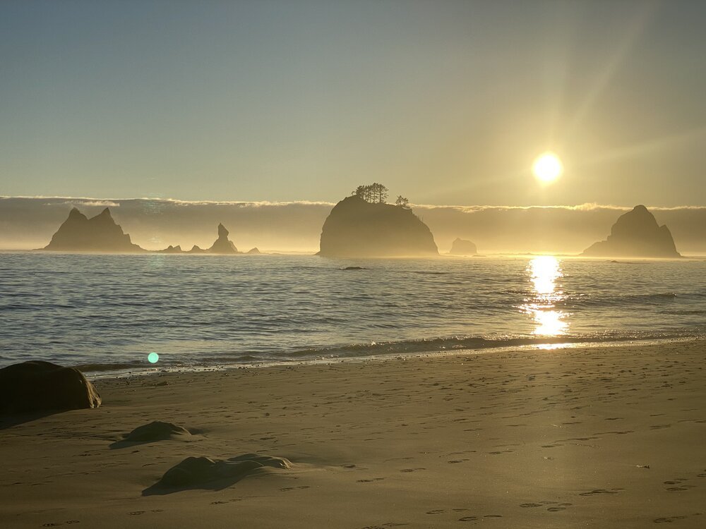
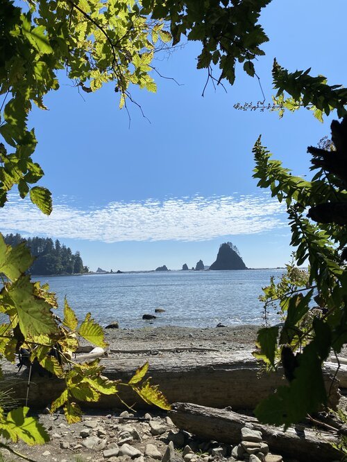
Imagine waking up to the whoosh of the ocean breathing and sea birds cackling offshore. You can smell a mix of sea salt and conifer. Sunlight is just starting to illuminate the massive stone monoliths lazily bathing offshore. Tendrils of morning mist are swirling upwards as the day heats up. It’s morning on the Wilderness Coast!
The Adventure
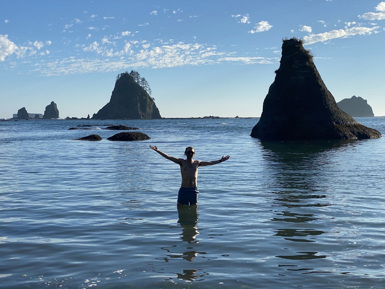
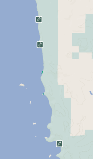
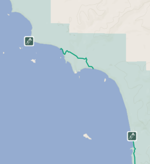
The summer of 2020, in the midst of the pandemic, my partner and I decided we needed to get out of the populated Seattle area and explore a place on our bucket list. The Wilderness Coast is located on the Olympic Peninsula and is a unique coastline protected with a wilderness designation within the Olympic National Park. The park protects 48 miles of coastline called the Daniel J. Evans Wilderness. Its pristine beaches and forests provide the perfect landscape for an adventurous day hike or longer backpacking trip. The two sections of trail, aptly named The North Coast and The South Coast, are divided by the Quillayute River.
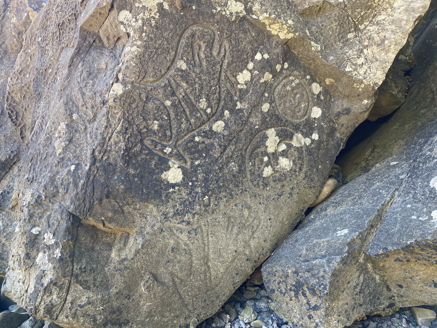
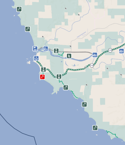
The Olympic Coast is home to the Makah, Ozette, and Quileute tribes. During the pandemic, their borders have been closed to outside travelers for the safety of community members. In addition, the coast north of Cape Alava including Shi Shi Beach and the Ozette Indian Reservation are closed. Due to the closure, we planned to backpack from the Ozette Ranger Station to Oil City with a quick 9.1-mile drive around the Quileute Reservation in the middle. We planned our trip to be 6 days on trail with an extra day at the start to pick up our bear canisters and drive up to Hurricane Ridge for a short hike and sunset views.
Please remember that these are wild and protected areas — respect the lands and sea creatures you find.

Challenges on the Trail
Before you grab your boots and backpack and head out the door, be sure to plan out the logistics of your trip ahead of time. This beautiful natural coastline may seem just like a walk on the beach, but it requires some planning before you take off on this adventure.
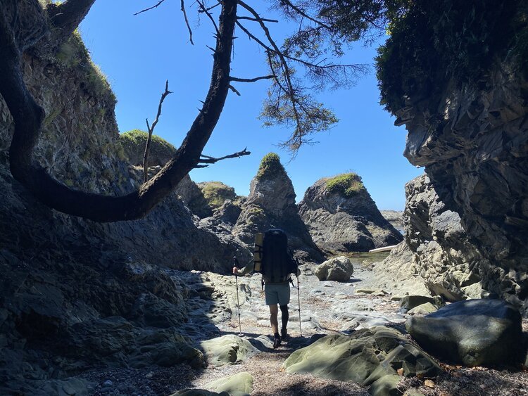
This backpacking trip is unique for its variety of terrain. You will want a sturdy pair of boots or trail runners with plenty of traction for this adventure.
You will also need to consider a good backpack that is comfortable and not too heavy, along with appropriate clothing for various temperatures.
Most of our mileage each day was much shorter than a typical backpacking trip due to the nature of the terrain.
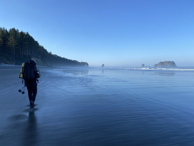
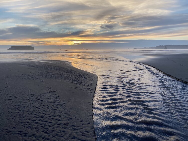
You will find yourself slipping and sliding over boulders and cobbles lain with barnacles and seaweed, as well as smooth everlasting sand beaches newly wetted by the tide. Although you can travel quickly on the flat sandy beach sections, the many rocky sections will slow your pace extensively and require more than leg strength to hoist yourself and your pack up and over boulders.
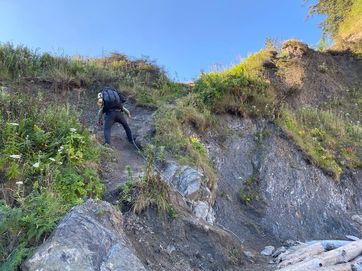
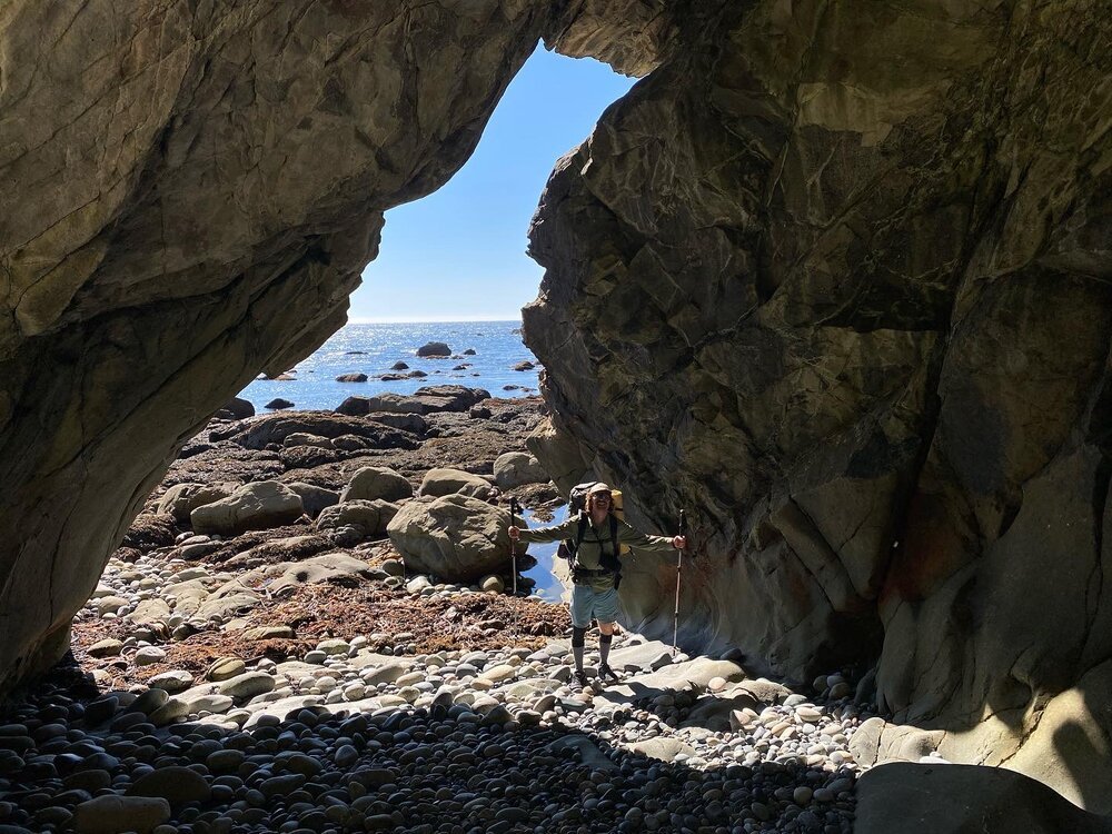
For balance, I highly recommend a good pair of hiking poles with rubber tip grips. There are a number of trail segments that take you over points of land called heads. These geographic features are formed by the hydraulic action of waves. These heads can be very dangerous to round by beach, and there are several segments where the overland route cutting across the neck of the head is mandatory.
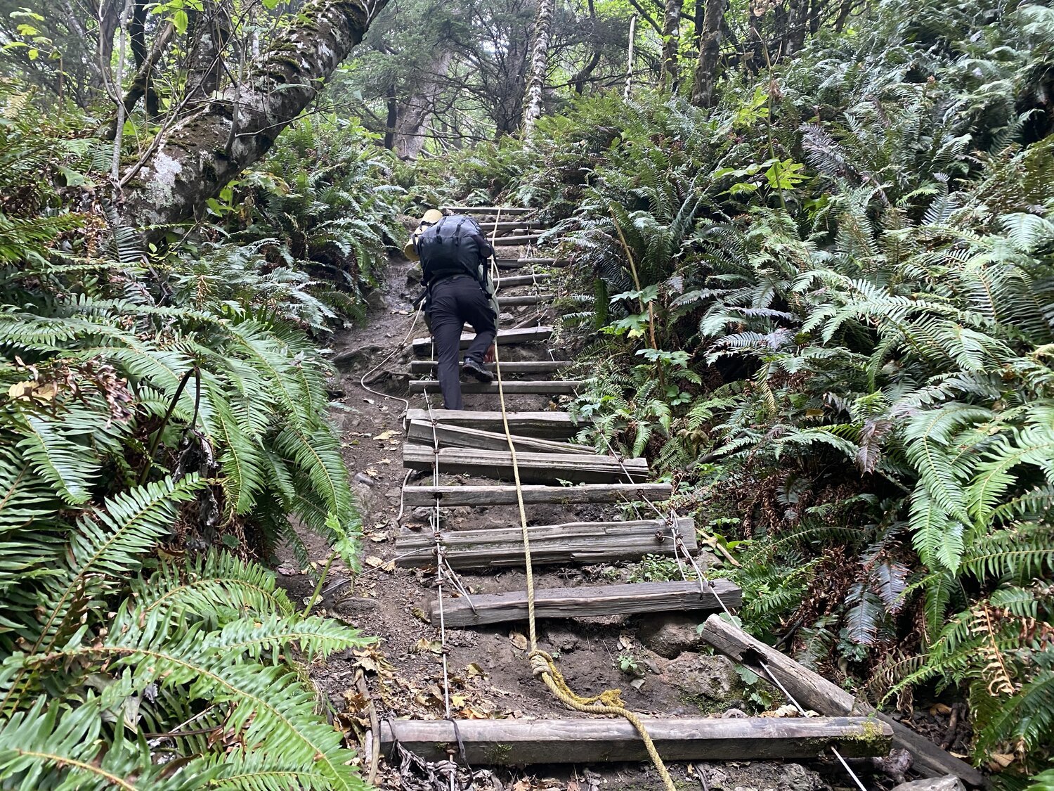
The inland trails include steep eroding hillsides that are often fixed with ropes and ladders to help the weary traveler jostle their way up and down. There is also plenty of trail that takes you meandering through the sweet-smelling rainforest dotted with banana slugs.
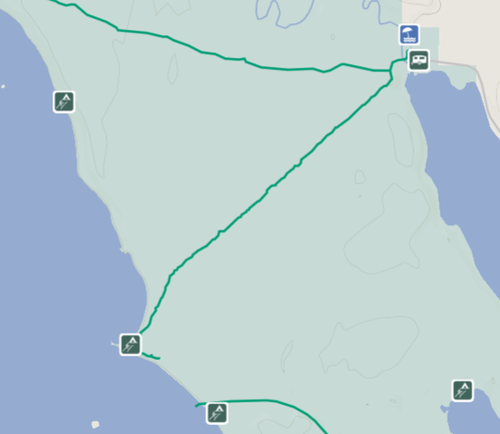
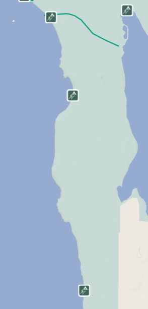
Before going, make sure to pick up a USGS topo map and also download the Olympic Region of our free Outdoors NW App that allows you to navigate offline. The Outdoors NW web map and apps show all of the actual trail segments, designated camping areas, and other recreation facilities, but they do not map the “trail” segments along the beaches, and they do not have the most recent alerts and restrictions found on the USGS topo.
Tide Management
One of the fun parts about this trip is that you are truly on nature’s watch. We spent a whole three hours hanging out on a beach waiting for the tide to go down one day. Planning ahead to make the most of your day based on tides is a must. Occasionally you will also have to leave really early if you want to get around a head and to your camping spot before it gets dark. When you pick up your bear cannisters at the ranger station, you will also want to pick up a tide chart. There will be two high tides and two low tides per day. The height of each tide will determine if you can round a head in the middle of the tide change or if you have to wait all the way until low tide. On the USGS topo maps of this route, it will tell you what level of tide is needed to round each point. The map will also point out if the head is impassible or dangerous and show an overland trail option. If you really want to plan this out well, get a tide chart at your local fishery supply store ahead of time so you can find a span of days that will give you optimum tides for the section of trail you want to do.
Permitting
This is a wilderness area, so you will need to reserve and purchase permits for each location you plan to camp. You can reserve your permits up to 6 months in advance on recreation.gov. Your permits will be issued to your account 5-7 days before your trip. You can then log in and print them at home. Due to the current COVID-19 pandemic, Wilderness Information Centers are closed but were issuing bear canisters last summer. You will have to check the nps.gov website to find out how logistics for getting bear canisters changes as the year progresses. There are staff available to answer questions outside of WIC buildings during certain hours or by phone. Additional staffing may be available during the summer of 2021, but be sure to double check.
Camping
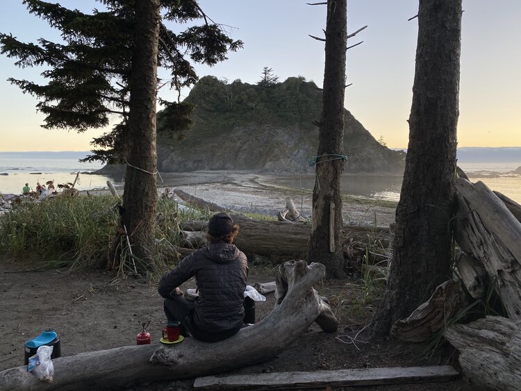
Campfire at Norwegian Memorial.
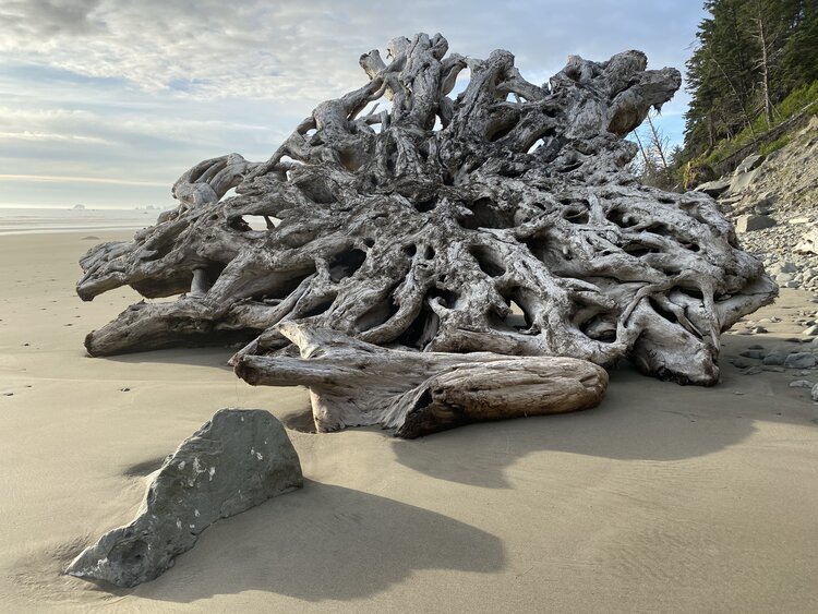
There are limited designated camping spots inland from the beach that are more protected from wind and rain, but they also cause more impact to the land. There is plenty of camping on the beach (just make sure to camp well above the high tide line!). You will find flat little nooks surrounded by beach logs that people have erected as a wind screen. Find yourself a cozy spot to call your beach abode for the night and enjoy some clear starry nights in the summer months. If you are early enough, and with a bit of luck, my two favorite locations to choose an inland camp are at Strawberry Point and Mosquito Creek. Strawberry Point has several large inland camping spots with incredible views of the Giant’s Graveyard and a castle-like sea stack right at the tip of the point. Mosquito Creek has camping inland that is perched up on the bluff. This gives the camper a unique perspective. We felt like bald eagles perched up in our nest looking out over the ocean and black cliffs of Alexander Island. Enjoying a campfire with salt-soaked beach wood is a favorite pastime of mine. The salty swirls of smoke and toasty vibrant coals are one of the best ways to wrap up a day. Be sure to pick only driftwood for burning and set up the fire below high tide. Once you have finished your fire, put it out with sand and, before leaving camp, scatter the ashes below the high tide line so it will wash away and be dispersed. Many of the water sources along the trail are small trickles or little ponds up in the forest. We found a water source at every camping spot, but sometimes you had to walk a little way down the beach. A USGS topo map will show where small water sources are. Be sure to bring a good filter pump on this trip. Some of the still water is colored amber from trees leaching tannins. This is still safe to drink if filtered like the rest of your drinking water. Each camping area will also have a pit toilet, though it sometimes takes a bit of time to search it out. Just ask your neighbors if you can’t find it!
Shuttling
Technically speaking, if you were just going to backpack the north or south sections of the Wilderness Coast trail, you could definitely drive two cars and park one at each end of the trail, but it’s no fun to drive alone! If you are planning to do both sections like we did, north to south, you will need to get creative in order to get a ride on the 8 miles of road from Rialto Beach (where the north section ends) to Third Beach (where the south section starts). Prior to the COVID-19 pandemic, one could potentially hitchhike this section, but that’s not really an option now. So instead, we invested in the trustworthy (and very friendly) Olympic Hiking Company shuttle service. They provide rides between the Ozette Ranger Station and Rialto Beach and between Third Beach and Oil City. We opted to park our car at the Rialto Beach overnight parking lot and get a ride to the Ozette Ranger Station. We then were able to drive our vehicle to Third Beach parking lot and refuel our packs with the rest of our food for the second half of the journey. On our way out at Oil City we hopped on the shuttle and got a ride up to Third Beach where our trusty Toyota Sienna awaited us. It was well worth the money to not have to fuss with shuttling multiple cars of our own. Plus, the roads between the north and south sections of the coast trail take over an hour to drive each way, so it was great to get a little rest in at the end of our hike and know that we could drive straight home once we got to our car.
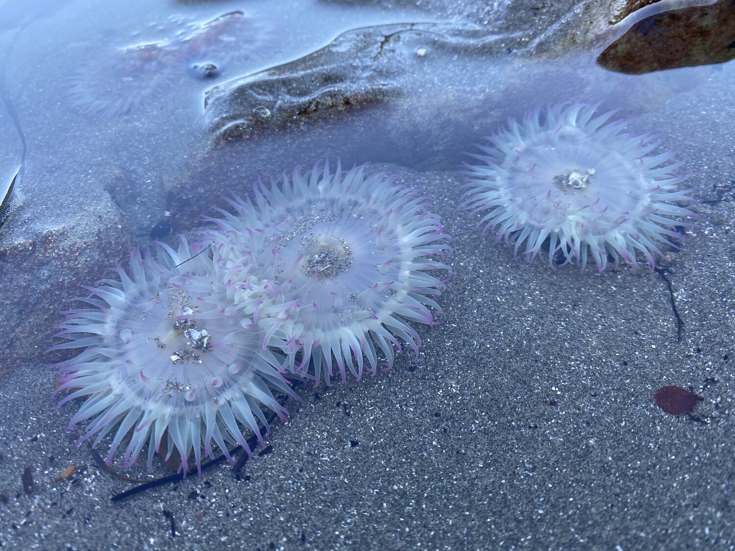
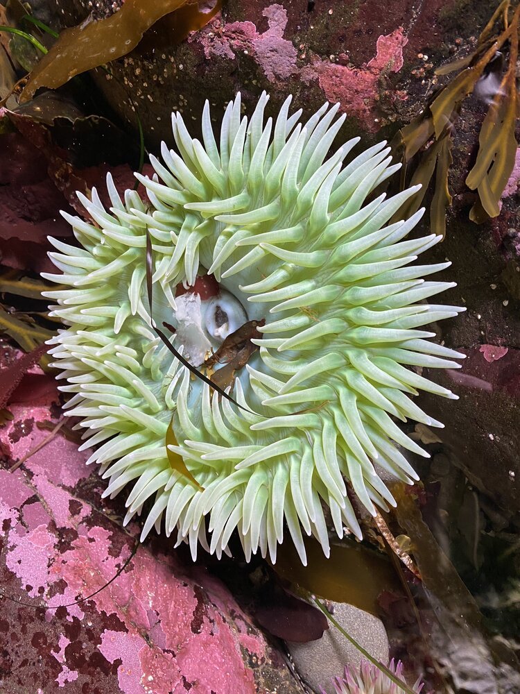
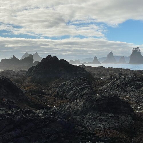
Tide Pooling and Wildlife
Banana slug on a leaf.
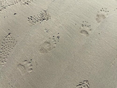
If you are an avid invertebrate enthusiast or even a novice nudibranch identifier, you will find plenty to keep your underwater imagination flowing. Bring a lightweight pair of water socks with a sturdy sole and get out into the low tide zones. Walk carefully so as not to crush creatures as you explore. Try to walk on bare rock surfaces that don’t have barnacles or muscles growing, and if you do walk in the water, tread lightly. If you turn over any rocks, gently replace them just the way you found them. Touch creatures lightly. If they resist being removed from their spot, don’t try to pry them off as this will damage their feet or organs! Some of the many creatures you may spot include small brown speckled fish called sculpin, red rock crab and kelp crab, various sea anemone, sea stars, and if you are lucky—a nudibranch! As you hike along near shore and in the forest, keep your eyes peeled for bald eagles and osprey, banana slugs galore, Douglas squirrel, black bear, harbor seals (don’t touch or move a pup or their mother may abandon them), pigeon guillemot, marbled murrelet, and river otters. Watch for the exhale of whales or porpoise offshore (orca and minke whale in the summer and fall, gray whale in the spring and fall, and humpback whale in the fall). Listen for the sharp barks of sea lions offshore as well. On our first day we spotted some black bear prints in the newly wetted sand, meaning it had passed through not long before!
Itinerary
We took 7 days in total coming from the Seattle area. The first day was spent getting out to the Olympic Peninsula by the Edmonds ferry and picking up bear canisters (which are required) from the Port Angeles Ranger Station. The rest of the day we spent packing up our gear and taking a short hike with a sunset view on Hurricane Ridge. That evening we stayed at the Lyre River DNR camping site. The next 6 days we spent on the trail with the last day including our drive back home.
Day 1: Drive out to Port Angeles.
Day 2: Shuttle from Rialto Beach to Ozette Ranger Station, hike to South Sandy Point – 8.6 miles
Day 3: Hike from South Sandy Point to Norwegian Memorial – 5.1 miles
Day 4: Hike from Norwegian Memorial to Chilean Memorial – 6.3 miles
Day 5: Hike from Chilean Memorial to Strawberry Point (in between, drive car from Rialto Beach to Third Beach parking lot) – 9.4 miles
Day 6: Hike from Strawberry Point to Mosquito Creek – 5.8 miles
Day 7: Hike from Mosquito Creek to Oil City, shuttle back to Third Beach parking lot – 6.1 miles
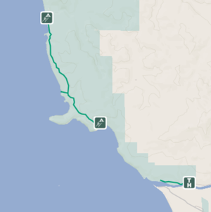
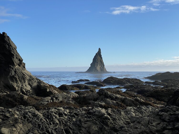
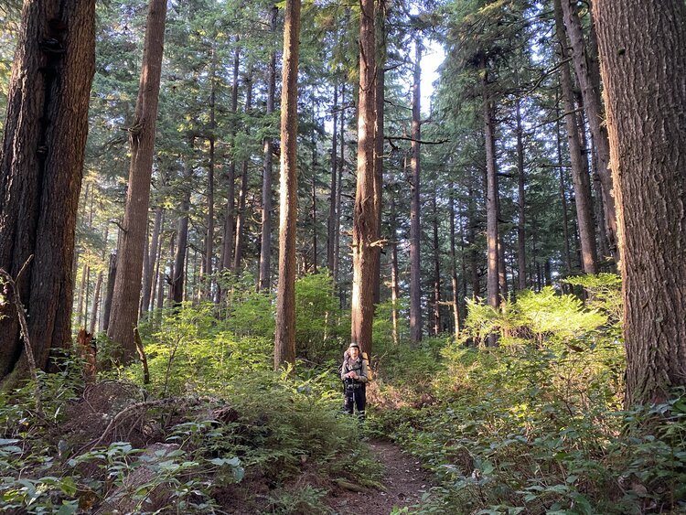
Photo credit for all of the pictures in this post: Cailen McDevitt